
Main Facts: Eastern Seaboard Braces for Impending Landfall
The India Meteorological Department (IMD) has issued a severe storm warning across the eastern coast of India as a deep depression over the Bay of Bengal rapidly intensifies into Cyclone Arnab. Meteorological projections indicate that the system will evolve into a "Very Severe Cyclonic Storm" before making landfall along the Andhra Pradesh coast, between Bapatla and Visakhapatnam, on the morning of October 28, 2026. The storm is forecast to carry sustained wind speeds ranging from 115 kmph to 125 kmph, with gusts reaching up to 140 kmph, accompanied by torrential rainfall and storm surges.
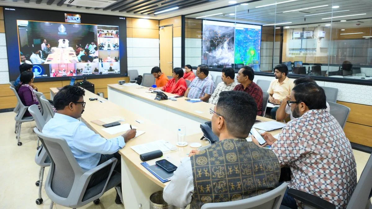
In response to the escalating threat, state governments in Andhra Pradesh and Odisha have placed coastal and adjoining interior districts on high alert. Disaster management mechanisms, military assets, and emergency services have been mobilized. In Odisha, Chief Minister Mohan Charan Majhi has taken the unprecedented step of deputing eight senior cabinet ministers to oversee relief, evacuation, and mitigation operations in vulnerable districts. Simultaneously, Revenue and Disaster Management Minister Suresh Pujari chaired a high-level coordination meeting in Bhubaneswar to review operational readiness.
In Andhra Pradesh, Chief Minister N. Chandrababu Naidu directed the state machinery to maintain 24/7 vigilance, emphasizing zero casualty targets, mandatory evacuations from low-lying coastal regions, and the pre-positioning of essential commodities. The storm’s atmospheric reach is also driving widespread precipitation across southern India, with the active Northeast Monsoon triggering heavy rainfall in parts of Tamil Nadu.
+-----------------------------------------------------------------------------------+
|                            CYCLONE ARNAB: AT A GLANCE                             |
+----------------------+------------------------------------------------------------+
| System Status        | Deep Depression -> Very Severe Cyclonic Storm               |
| Expected Landfall    | Morning of October 28, 2026                               |
| Target Coastline     | Between Bapatla and Visakhapatnam (Andhra Pradesh)        |
| Sustained Wind Speed | 115 - 125 kmph (Gusting to 140 kmph)                      |
| Primary Impact Zones | Andhra Pradesh, Odisha, Tamil Nadu (Monsoon Synergy)       |
| Key Key Directives   | Evacuations, 8 Ministers Deputed (Odisha), 24/7 AP Control |
+----------------------+------------------------------------------------------------+
Chronology of the System: Development and Trajectory
The evolution of Cyclone Arnab highlights a rapid process of cyclogenesis typical of post-monsoon atmospheric disturbances in the Bay of Bengal during October.
October 23–24, 2026: Incipient Formation
The system originated as a low-pressure area over the east-central Bay of Bengal. Driven by elevated sea surface temperatures (exceeding 29°C) and low vertical wind shear, the atmospheric disturbance rapidly organized into a well-defined cyclonic circulation, moving in a west-northwestward direction.
October 25, 2026: Consolidation into Deep Depression
By late October 25, the IMD classified the system as a depression, which subsequently consolidated into a deep depression. High-resolution satellite imagery confirmed the development of dense convective cloud masses wrapping around a central core. High-level ministerial meetings were convened in Bhubaneswar and Amaravati to transition state mechanisms from advisory states to operational readiness.
October 26, 2026: Escalation and Name Assignment
During the early hours of October 26, the deep depression tracked southwestward before altering course back toward the north-west. The IMD’s morning bulletin officially identified the system’s trajectory toward becoming Cyclone Arnab, predicting rapid intensification into a Very Severe Cyclonic Storm within 24 to 36 hours as it draws heat energy from the central Bay of Bengal.
Expected Trajectory (October 27–28, 2026)
- October 27: The storm is projected to reach peak intensity over the west-central Bay of Bengal, generating severe sea turbulence and sustained storm-force winds.
- October 28 (Morning): Expected landfall along the Andhra Pradesh coast, traversing the coastal stretch between Bapatla and Visakhapatnam, followed by gradual weakening as the storm moves inland toward interior peninsular India.
Supporting Data: Meteorological Parameters and Hazard Profiles
The IMD’s numerical weather prediction models highlight multi-hazard operational risks across wind, precipitation, and sea inundation metrics.
                       PROJECTED CYCLONE PATH & IMPACT

    [ Bay of Bengal ]  ----->  [ Deep Depression ]  ----->  [ Cyclone Arnab ]
                                                                   |
                                                                   v
+------------------------------------------------------------------+--------------------------------------------------+
|                                    LANDFALL ZONE: Bapatla to Visakhapatnam                                           |
+------------------------------------------------------------------+--------------------------------------------------+
|  Wind Profile: 115-125 kmph (Gusts to 140 kmph)                 |  Rainfall Profile: Extremely Heavy (>204.4 mm)    |
|  Storm Surge: 1.0 - 1.5 meters above astronomical tide           |  Sea Condition: Rough to Phenomenal              |
+------------------------------------------------------------------+--------------------------------------------------+
Wind Dynamics
At the time of landfall, sustained winds of 115 to 125 kmph are expected near the center of the storm, with peak gusts reaching 140 kmph. Outer wind bands are anticipated to affect coastal districts up to 150 kilometers from the eye of the storm, bringing gale-force winds of 60 to 80 kmph as early as the evening of October 27.
Rain and Hydrological Predictions
The atmospheric interaction between Cyclone Arnab and the ambient Northeast Monsoon is predicted to cause extremely heavy rainfall events (exceeding 204.4 mm in a 24-hour window) across coastal districts.

- Andhra Pradesh: Red Alerts have been issued for Visakhapatnam, Anakapalli, Kakinada, Central Godavari, West Godavari, Krishna, Guntur, and Bapatla districts.
- Odisha: Heavy to very heavy rainfall alerts cover Ganjam, Puri, Jagatsinghpur, Kendrapara, Khordha, and Bhadrak districts.
- Tamil Nadu: Continuous rainfall triggered by monsoon active dynamics is expected across northern coastal districts, including Chennai, Chengalpattu, and Thiruvallur, through October 27.
Marine and Coastal Surge Risks
- Storm Surge: Oceanographic modeling indicates a storm surge of 1.0 to 1.5 meters above the astronomical tide, which threatens to inundate low-lying coastal villages in Andhra Pradesh during landfall.
- Sea Conditions: Sea conditions over the west-central and adjoining southwest Bay of Bengal are categorized as "Phenomenal" (wave heights between 9 and 14 meters). Total bans on fishing and maritime operations have been enforced across Andhra Pradesh, Odisha, and Tamil Nadu coasts.
Official Responses and State-Level Preparedness
Odisha Emergency Deployment
Odisha has activated its disaster response framework, leveraging protocols refined over decades of coastal storm management.
+-----------------------------------------------------------------------------------+
|                        ODISHA DISASTER MANAGEMENT SETUP                           |
+----------------------+------------------------------------------------------------+
| Ministerial Oversight| 8 Cabinet Ministers assigned to high-risk coastal districts |
| Key Leadership       | CM Mohan Charan Majhi & Disaster Minister Suresh Pujari    |
| Operational Units    | ODRAF, Fire Services, and National Disaster Response Force |
| Priority Action      | Shelters, evacuation, power restoration, food security     |
+----------------------+------------------------------------------------------------+
Chief Minister Mohan Charan Majhi has assigned eight cabinet ministers to reside in and supervise operations in eight designated high-risk districts. Revenue and Disaster Management Minister Suresh Pujari held a high-level briefing in Bhubaneswar, mandating the following actions:
- Evacuation Mandates: Identification and evacuation of populations living in kucha (temporary) houses, mud huts, and low-lying coastal settlements to reinforced cyclone shelters.
- Asset Pre-positioning: Deployment of Odisha Disaster Rapid Action Force (ODRAF), state Fire Services, and National Disaster Response Force (NDRF) teams equipped with tree-cutters, high-capacity water pumps, and satellite communications.
- Essential Services Contingency: Auxiliary power generators have been allocated to primary healthcare centers and district hospitals to ensure uninterrupted power during grid failures.
Andhra Pradesh Administration Moves
Andhra Pradesh Chief Minister N. Chandrababu Naidu led a series of review meetings with district collectors, disaster management officials, and port authorities.
- Control Rooms: District-level 24/7 command centers have been activated with direct feeds from the state emergency operations framework.
- Fishermen Safety: Ground patrols along beaches and harbors have secured all registered fishing vessels, ensuring no craft remain at sea.
- Infrastructural Mitigation: Port operations at Visakhapatnam, Gangavaram, and Kakinada have initiated safety protocols, suspending cargo operations and clearing anchorage zones.
Tamil Nadu and Central Agency Alignment
In Tamil Nadu, local municipal corporations are clearing drainage corridors and monitoring urban reservoirs as the active Northeast Monsoon causes persistent rainfall. At the central level, the Indian Coast Guard (ICG) and the Indian Navy have placed surface ships, aircraft, and specialized diving units on standby across regional hubs in Chennai, Visakhapatnam, and Paradip to perform Search and Rescue (SAR) operations if required.
Implications: Socio-Economic and Infrastructure Risk Assessment
The approaching storm presents critical challenges across agricultural, industrial, and social domains along the eastern seaboard.
+------------------------------------------------------------------------------------+
|                         CROSS-SECTOR IMPACT ASSESSMENT                             |
+------------------+-----------------------------------------------------------------+
| Sector           | Primary Vulnerabilities & Risk Profiles                         |
+------------------+-----------------------------------------------------------------+
| Agriculture      | Harvest-ready paddy, sugarcane, and standing horticulture crop  |
|                  | loss due to lodging, standing water, and strong winds.          |
+------------------+-----------------------------------------------------------------+
| Infrastructure   | Power grid collapses, telecom towers damage, rural road wash-  |
|                  | outs, and disruptions to coastal highway logistics.             |
+------------------+-----------------------------------------------------------------+
| Maritime Ports   | Operational halts at Visakhapatnam, Gangavaram, and Kakinada;   |
|                  | risks to shipping lanes and coastal fishing fleets.             |
+------------------+-----------------------------------------------------------------+
| Coastal Housing  | Extensive physical risk to non-pucca structures; displacement   |
|                  | risks for vulnerable coastal communities.                       |
+------------------+-----------------------------------------------------------------+
Agricultural Risks
The landfall window coincides with a crucial harvest period for rice paddy, sugarcane, and horticultural crops across coastal Andhra Pradesh and southern Odisha. Severe winds pose risks of crop lodging, while heavy rainfall threatens field flooding, raising concerns about post-harvest losses and supply chain disruptions for regional agricultural markets.
Port Logistics and Marine Trade
The Bapatla-Visakhapatnam coast houses major commercial shipping hubs. Operational suspensions at key ports will interrupt bulk cargo handling, petroleum distribution, and container traffic. Maritime advisories have redirected commercial shipping channels away from the central Bay of Bengal, extending transit times across regional sea lanes.
Infrastructure Vulnerabilities
High wind speeds present direct threats to power transmission infrastructure, high-voltage lines, and mobile telecommunication towers. Rural coastal roads face risk of erosion and blockages from fallen trees and storm debris, requiring continuous clearing operations to maintain emergency access channels.
Long-Term Climate Perspectives
Cyclone Arnab illustrates the ongoing trend of post-monsoon cyclonic events in the Bay of Bengal, where elevated ocean thermal energy levels support rapid storm intensification. As emergency crews complete preparations ahead of the October 28 landfall, the effectiveness of coordinated evacuation efforts, ministerial oversight, and disaster planning remains central to mitigating risks to human life and critical coastal infrastructure.